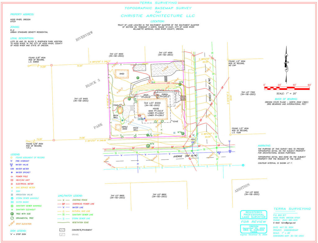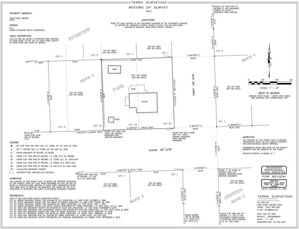
A land survey is a detailed process used to determine the boundaries, features, and dimensions of a piece of land. Conducted by professional surveyors, this process involves measuring and mapping the land’s physical characteristics to create accurate and precise drawings. Land surveys are essential for a variety of purposes, including property transactions, construction projects, and land development. They help establish legal property boundaries, identify potential issues with land use, and provide the necessary information for planning and compliance with regulations.
There are many different types of land surveys, each serving various purposes depending on the needs of the project. Architects most frequently use a topographical survey, also know as a base map survey.
What does a topographical survey involve?
A topographical survey is crucial for site development, building additions, and infrastructure projects. It provides a comprehensive base map that architects use as a starting point for design. It includes detailed information on site features, including:
- Property lines,
- Easements,
- Spot elevations,
- Topography lines,
- Trees,
- Structures,
- Hardscaping,
- Driveways,
- Streets and sidewalks, and
- Utilities.
Understanding the exact location of your property lines is essential to determine zoning setback lines and ensure compliance with local regulations. Additionally, a topographical survey shows site contours, trees, vegetation, and existing utilities, all essential information for properly locating your building relative to your property’s specific characteristics.

If your project needs further clarification on property lines and legal descriptions, the surveyor may add a boundary survey.
Tell me more about a boundary survey.
A boundary survey focuses on further identifying property lines and defining the legal description of a property. This type of land survey is particularly important when dealing with unique property situations, such as resolving disputes with neighbors, building fences, or planning new construction. Surveyors use stakes and bright pink ribbon to mark property corners, providing clear and visible boundaries for all interested parties to see.

Once all parties have a chance to weigh in on the location of the property lines, the surveyor installs permanent monuments (usually iron rods) at the property corners. They then produce a drawing and record it with the county, making it part of the public record. This allows future surveyors to reference and verify previous work, ensuring consistency and accuracy in property records. Although not always required, surveyors often recommend a boundary survey before starting construction to clearly establish and verify property lines for all parties.
I found an iron rod on my property. Can I remove it?
No! As you can see from above, a significant amount of work goes into locating those rods. If you remove them, future surveyors will have to redo that work. The more monuments that remain in the ground, the easier it is for everyone to accurately locate their property lines.
I’m building a new house. Do I need a land survey?
Yes, when building a new house, you will need both a topographical and a boundary survey.
I’m renovating my existing building. Do I need a land survey?
It depends on the scope of your renovation. If your project is limited to the interior of your building or doesn’t expand the building footprint, you won’t need a survey. In these cases, there are no changes affecting the building’s relationship to the property lines.
However, if you’re planning an addition to your building, particularly if it’s near a property line, a topographical survey is essential. Your architect needs to verify the exact location of the property lines to ensure that the new addition complies with zoning regulations and does not encroach on any setbacks. You may also choose to file a boundary survey with the county–your architect and surveyor can advise accordingly.
Can Christie Architecture help with my survey?
Absolutely! If your project requires a land survey, Christie Architecture can manage the process by hiring and coordinating directly with the surveyor prior to the Schematic Design phase. We know exactly what information to gather and how to coordinate the survey details with our work. Give us a call to get started!
